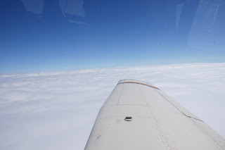
It rained a lot last night on our way home from a great Berkshire Playwright's Lab performance. Even though we had checked the weather before bed, we didn't quite know what we would awaken to. But we decided to head out into cloudy wet skies taking off from GBR at around 9.20am.
We were soon in the clouds and climbing to our assigned altitude of 8000ft.
We broke out of the clouds on top of a thick layer to a warm sunshine for most of the time and headed west towards Buffalo. The headwind was strong and we barely made 90 knots ground speed for most of the way.
We began checking weather at our destination area (Buffalo) as well as airports along the way. Most airports were reporting an overcast ceiling of around 800 ft with 3 miles of visibility.
It soon became apparent that we would not be landing at our planned fuel stop at Buffalo/Lancaster as that airport does not have an instrument approach. So we tossed up between Buffalo International and Genesee County and chose the latter because of fuel there at $1.50/gal cheaper.

Rochester Approach Control cleared us for the RNAV Runway 32 Approach and we broke out of the clouds at about 2000 feet with a clear view of the runway ahead.
We refueled, ate a few vending machine snacks while flight planning the next leg. On our IFR flight plan we asked for a scenic detour over Niagara Falls and the same over the city of Toronto. We didn't imagine it was possible we would get them both on an IFR flight plan or if the weather would be good enough for a view of anything. But we got lucky on all counts.
No comments:
Post a Comment