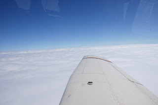
After waiting out the weather in Anchorage we finally made it to Fairbanks. Departing out of Merrill field in a low overcast we made our way up the valley towards Talkeetna as the overcast gave way to broken and then scattered clouds. To our surprise, through the scattered layer we got a full on view of Denali, soaring to over 20,000ft off our left side. The journey up the valleys and through Windy Pass was relatively easy with good visibility and just a few rain showers here and there. The pass was steep and tight with mountains off either wing before crossing into the tundra and an easy descent into Fairbanks.
Fairbanks International is an awesome airport with a float plane landing pond between two long parallel runways. The float plane "runway" is designated 20W - the "W" for "water". We landed on 20L and taxied to the East Ramp where we found there was an airplane camping area on the field just off from the float plane pond. We decided to take advantage of it and camp the night. We taxied the plane into our camping spot and set up our tents. There was an immaculate toilet and shower building and another shelter with grill, tables, a fish smoker. A bicycle rack with bicycles for our use was also a surprise. With such great facilities, it was easy to enjoy our first "plane camping" night of the trip.
Flying a Piper Archer from Massachusetts to Alaska - Spring 2010. Describes the adventures and includes photographs of some of the highlights.
Tuesday, June 29, 2010
Sunday, June 27, 2010
Glaciers
What a great day! We decided to take the train from Anchorage to the port of Whittier and then go on a glacier cruise.
The train ride was a great start to the day. It was a modern and comfortable train with commentary along the way - a 2 hour scenic packed ride that emerges from a 2.5 mile long tunnel through the mountains to Whittier. We found two companies offering a glacier cruise and chose the one that we thought offered the best lunch. We really lucked in. The company, Major Marine Tours, does everything right.
For six hours we cruised Prince William Sound, saw a dozen or so glaciers, two humpback whales, sea otters, seals, two bald eagles, ice breaking off glaciers, and majestic scenery. Shortly after leaving dock we were provided with a buffet lunch consisting of fresh caught wild Alaskan Copper River Salmon, prime rib, and an assortment of sides, salads, dessert, and drinks.
Friday, June 25, 2010
Last leg into Anchorage
Pictures from our last leg into Anchorage AK following the Glenn Highway through several mountain passes. Note the glaciers we passed and the steep mountain passes we flew through. Apart from a few showers and build-ups over the mountains, the weather was good and we had a great up close view of some great scenery.
The highlight of our arrival in Anchorage was the "above and beyond" service we got from Michelle at Ace Fuels at Merrill Field (the airport we flew into - see bottom pic).
Michelle gave us a ride to our hotel with a tour on the way, info on places to go and places to eat, and was just a wonderful help. By and large we've been well treated at the various airports in our travels but this one was top of the list.
Alaska - we made it!
These photos were the last few miles in Canada before we crossed the border into Alaska. We cleared customs in Northway and had to wait about 40 minutes for the arrival of the customs office who turned out to be a nice guy after giving us a scare about not following proper reporting procedures. When you land to clear US Customs you are not allowed out of the airplane until the customs agent arrives, but we ended up standing on the wing and chatting with the other two aircraft that arrived about the same time.
Tuesday, June 22, 2010
We Crossed the Yukon River
Twice. Once flying in to Whitehorse and once in the cab on the way to town from the airport.
Today was our most challenging day as far as flying goes. Not wanting a repeat of yesterday where we flew half way to Watson Lake and had to turn back, we looked for other options.
The weather in Fort Nelson this morning seemed somewhat better than yesterday but the pesky low pressure trough off the Pacific is still sitting over the Rockies to our east and bringing rain showers, thunderstorms and low visibilities. The weather in Watson Lake was still reported as lousy with fog and rain showers. Not good for low level flying up river valleys. So we explored the option of going direct to Whitehorse by flying high and between cloud layers. The weather in Whitehorse was also reported as good for the whole day which was important as by the time we got there we'd have very little remaining fuel and no alternate.
We got a little assistance when a aerobatic show pilot by the name of Melissa who landed at Fort Nelson in her blue Extra while we were getting organized for the day. She was headed to Alaska for an airshow but today was also heading to Whitehorse. We all got weather briefings and decided to follow her and go direct to Whitehorse by picking altitudes along the way that would keep us above the terrain (mountains up to 9,000ft or more) and between the cloud layers. She was much faster than us and could also change altitudes quickly so from her view of things she could radio back to us what it looked like at various altitudes. When she told us she had to go to over thirteen thousand feet to get above one solid chunk of cloud we knew we had to ask for almost maximum effort from our Piper Archer. The temperature was also just about right for there to be ice in the clouds so we needed to be very careful. Unfortunately, the time between when Melissa reported the cloud tops and we got to the same place, the tops had risen and even at 14,000 ft were were still going to be in cloud. We knew from another report that the cloud bank only extended about 20 miles before giving way to scattered layers and good visibility. So we called up Whitehorse Radio and picked up an IFR clearance and were cleared direct to Whitehorse at 12,000 ft. in cloud but fortunately with no ice.
As predicted we were not in the clouds for long and broke out on top of a scattered layer that gave some great views of the still partly snow covered mountains, deep gorges, and snaking rivers below.
We flew through just a little more cloud on our approach into Whitehorse and then broke out to a stunning view of the airport, the town, and the Yukon River.
We had hoped to go on to Northway and so make it in to Alaska but found that US Customs closed at 4pm and we wouldn't make it in time. So here we are in Whitehorse where it was difficult to find a hotel and impossible to find a rental car. Apparently things get busy up here. But Billy's Taxi got us to a motel in town with an entertaining run down on the town and the Yukon as we drove in.
We also found today that the four hour flight not only stretched us and our airplane to capacity but our bladders as well. Luckily we had brought the required equipment along for just such a situation.
Monday, June 21, 2010
Heading East?
Yes, today we flew about 70 miles in an easterly direction after turning back to Fort Nelson on our way from there to Watson Lake. We had flown under a low overcast over some fairly high terrain to get to the Liard River and follow it and the Alaska Highway into Watson Lake. Unfortunately the overcast got lower and eventually the valley we wanted to follow became obscured by rain. Not wanting to mess with mountains either side in poor visibility, we took the wise and prudent choice and headed back to Fort Nelson.
There we met a father and son from Arizona who are also headed to Alaska and were stopped by weather. We spent some time chatting with them and some more time on the phone with Nav Canada weather briefers (who do an awesome job). After they told us of impending thunderstorms, unstable air, and the chance of worsening conditions, we decided to stay in Fort Nelson for the night.
Fort Nelson has four hotels and the Shell guy at the airport called around for us (after he had loaned us his truck to drive into town for lunch). Only one had rooms at a pretty high price. Why? Well Fort Nelson is booming. Oil and gas drilling as well as a lot of new construction. They are adding 80 rooms at the hotel we are staying at. There are also a lot of "fire bombers" stationed here and we saw some in action today at the airport. We also flew by two forest fires that were burning this morning but by days end after several "runs" by the fire bombers, they were out. One airplane used was an old four engined Electra.
Earlier in the day we enjoyed some great scenery in northern Alberta and British Columbia. Moving into BC today we gained another hour and have now gone through three time zones. The photo here is of the Peace River Valley which we crossed a few times and were amazed at the beauty of the river and the deep gorges it carves into the landscape.
Into the Wilds
After a great rest day in Edmonton we are heading out again today and hope the weather will co-operate. Our first stop will be Dawson Creek.
Then we hope we'll be able to get on to Fort Nelson and Watson Lake but will have to see how the weather goes. Showers are forecast.
Saturday, June 19, 2010
We're in Canada now eh! Day 3
We made it to Edmonton, Alberta. It's almost 10pm and the sun is still shining in the western sky as we look at it out the window of our 15th floor hotel room.
What a day. Two long 3 hour plus legs of great flying. It was raining and misty in Thief River Falls, Minnesota as the cab took us from our hotel to the local airport. We decided to head direct to Regina, Saskatchewan and clear customs into Canada then head west across the prairies to Edmonton. We launched IFR into a 600ft overcast but broke out on top at 4000ft to sunny skies with silky white clouds underneath. We talked to Minneapolis Center who handed us off to Winnepeg. We were going to be out of their radar coverage and communications for most of the flight so they gave us reporting points and frequencies to try at various times along the route. With no one to talk to and not much to look at, we cranked the Sirius radio to the Bruce Springsteen channel and checked the sports scores on ESPN News as we once again pushed into a headwind (although not quite as bad as yesterday).
The clouds soon gave way to a brilliant green landscape below as we passed over corn farms, wind farms, and oil fields in Manitoba and Saskatchewan. All of it flat, flat, flat.
Nearing Regina we set up for the RNAV Rway 31 approach and got vectored to final. The weather was pretty good but there was a misty haze that restricted forward visibility, hence the instrument approach. We taxied to Apron Two for our appointment with Canada Customs and Immigration. Two officers were there to meet us and were polite and professional and after a few questions and a look inside the airplane they stamped our passports and welcomed us to Canada.
We refueled and the Esso guy told us we could find a good lunch over in the airport main terminal. He was right. A burger for Chris and a BLT with Poutine for me.
We got a weather briefing and filed a flight plan for Edmonton. Chris flew while I worked on the navigation and boned up on the Canadian procedures for arrival into Edmonton. We also got to appreciate the beauty and diversity of the Canadian prairies and were in awe of how great it is to see all we did from a few thousand feet above it all at celebratory speed now in excess of 120kts. We landed at City Center Airport, right next to the downtown and with the help of the guy at the Shell AeroCenter (we like to spread the wealth) we found a great downtown hotel for $74/night. Thinking it would be good to eat something different to the midwest bar food we've been eating the last few days, we found a good inexpensive Japanese restaurant near the hotel. Edmonton looks and feels like a great city.
Initially we planned to stay just one night but decided we needed a rest day, so will have a no fly day tomorrow and explore the area a bit - most likely the famous Edmonton Mall.
Friday, June 18, 2010
Day 2 - Leg 2 Cloquette MN to Thief River Falls MN
Not exactly where we planned to be tonight but when we landed in a 30 knot wind and almost got blown away as we refueled the plane and then went inside to see a line of weather on the radar just to our north-west (where we were headed) we decided to call it a day. The headwinds were brutal today and we had continuous moderate turbulence as well for most of this afternoon's flight. Another cross swind landing which the locals tell us does not happen very often here.
Day 2 - First Leg - Sault Ste Marie MI to Cloquette MN
What a great day. Flying across the country in a small airplane brings days of diversity, just like we experienced today. Looking at the weather maps... we wonder....will we or won't we be able to get through that occluded front sitting just out there on our way to where we want to go. The weather looks great behind it but we have to get from here to there. We decide to launch with a few back up plans in mind. Other than the low overcast and rain ahead its a great morning as we climb out of the SOO (as folks here call Sault Ste Marie) and get cleared through the Canadian airspace just across the border right after takeoff.
We soon encounter the lower overcast and rain showers we saw on our computer graphics and manage to find clear air between the layers and nothing more than a little cloud before we break out into clear sunshine along the southern shore of Lake Superior. That is one BIG lake. We follow it's shore for almost two hours and detour a little to see the beautiful Picturesque Rocks - a place where there is a huge drop off of colored rock cliffs into the lake.
The weather is great but the wind has picked up. We listen to the weather at Cloquette and find we'll be landing in a crosswind with winds at 18kts gusting to 28 kts. A little bit more excitement to color our day.
After we land we meet Bill Stone from Venture North Aviation who offers to drive us to Subway for lunch. We enjoy an hour hanging out with Bill and sharing stories. One of those little unexpected but wonderful encounters that just happens on a journey like this.
Thursday, June 17, 2010
Day 1 Second Leg - Genesee Co/Niagara Falls/Toronto/Sault Ste. Marie
After a little discussion with both Clearance Delivery and Approach Control we hit the jackpot. Cleared to circle Niagara Falls twice at 4000ft (just under the overcast). What a sight! I flew while Chris got lots of pics, banking hard occasionally for a better shot.
Then across a hazy Lake Ontario into Canadian Airspace for a little more great service and co-operation from Air Traffic Control for a fly over the center of Toronto City at 2000ft for an upclose look at the CNN Tower - looking UP at it. Awesome!
Then a beautiful flight up the east side of Lake Huron over many islands to our destination at Sault Ste. Marie. The airport was deserted but we managed to find some wheel chocks, and a computer that worked. We found a room at Days Inn, enjoyed a much needed meal over some great conversation and celebration of a great start to our trip.
Day 1 First Leg - Great Barrington to Genesee County NY
It rained a lot last night on our way home from a great Berkshire Playwright's Lab performance. Even though we had checked the weather before bed, we didn't quite know what we would awaken to. But we decided to head out into cloudy wet skies taking off from GBR at around 9.20am.
We were soon in the clouds and climbing to our assigned altitude of 8000ft.
We broke out of the clouds on top of a thick layer to a warm sunshine for most of the time and headed west towards Buffalo. The headwind was strong and we barely made 90 knots ground speed for most of the way.
We began checking weather at our destination area (Buffalo) as well as airports along the way. Most airports were reporting an overcast ceiling of around 800 ft with 3 miles of visibility.
It soon became apparent that we would not be landing at our planned fuel stop at Buffalo/Lancaster as that airport does not have an instrument approach. So we tossed up between Buffalo International and Genesee County and chose the latter because of fuel there at $1.50/gal cheaper.
Rochester Approach Control cleared us for the RNAV Runway 32 Approach and we broke out of the clouds at about 2000 feet with a clear view of the runway ahead.
We refueled, ate a few vending machine snacks while flight planning the next leg. On our IFR flight plan we asked for a scenic detour over Niagara Falls and the same over the city of Toronto. We didn't imagine it was possible we would get them both on an IFR flight plan or if the weather would be good enough for a view of anything. But we got lucky on all counts.
Base to Final Rwy 29 Great Barrington
Saturday, June 12, 2010
SO WHY ALASKA?
That's a question I've been asked frequently as I talk with family and friends about our upcoming flying adventure to that great big state up North.
I never really thought much about it other than I've always wanted to go to Alaska. I think it started about the time I first heard the Johnny Horton song "North To Alaska" sometime when I was around nine. Sounded to me like Big Sam (the character in the song) made a good move when he left Seattle and headed north.
On top of that I love to fly. From my first ride in a DC3 when I was eleven years old, to flying gliders in outback Australia, to piloting my own Piper Archer to the Bahamas, renting a Turbo Arrow in Australia and flying around that big continent... I guess flying has been a pretty big part of my life esepecially the last 20 years.
So like many pilots, I had this dream of ONE DAY... flying to Alaska. That one day never came, mostly because I didn't want to do the trip solo and couldn't find anyone interested enough, brave enough, or stupid enough to go with me. Until Cousin Chris came along.
I guess it is good karma in a way because I take credit for introducing Cousin Chris to aviation on one of my visits to Australia in the late nineties. I took him for a flight at the local airport and he was hooked. Since then he's become the owner of a Yak 52, does aerobatics and formation flying, and generally has made aviation as big a part of his life as it is mine.
So when I suggested flying to Alaska, instead of the usual excuses I got from the few others I had asked, I got a great big "Hell yeah! When do we leave?"
So here we are, about to set off on this great flying adventure from Massachusetts to Alaska.
We'll try to post a daily update here and also some pics.
Another question we get is "What are you going to do when you get there?" I guess the process of getting there is so much fun, I haven't given much thought to that. I'd like to catch a big king salmon though and I think Cousin Chris has got a desire to visit Wasilla for some reason.
Anyway, if you'd like to follow along with us, just click on the subscribe button.
We'd love to know who is following us and we'd also like you to share your comments on out posts and pictures.
Wednesday, June 9, 2010
The Latest Plan
After spending many hours pouring over flight plans (mostly using AOPA's Flight Planner), I have revised our itinerary yet again. Cousin Chris wants to see Niagara Falls so we'll head for there to start with and hopefully talk our way into a fly over. I've flown over them before and even from the altitude of 3500ft they look pretty impressive. Our first night will then probably be in Sault Ste. Marie in Michigan which we'll reach by going through Canada - passing directly over Toronto and hopefully getting a good view of that fair city.
Next day we'll head out through Michigan's upper peninsula on the southern shore of Lake Superior. Then into Minnesota and North Dakota. From there we'll track up across the border in Canada and make it to Regina, Saskatchewan to clear Canadian Customs and for our second overnight.
Day 3 will see us heading across towards Edmonton, Alberta and then on up to Dawson Creek where we'll probably overnight.
Next day will take us from Dawson Creek to Whitehorse in the Yukon. We'll be mostly following the Alaska Highway up the valleys and avoiding the more mountainous and desolate direct route.
On the Fifth day after we leave home we'll hopefully arrive in Alaska at Northway where we'll clear US Customs. From there we'll go to either Fairbanks or Anchorage depending on weather and fires. (We here there are a lot of forest fires burning in Alaska at present).
Of course this entire plan is weather dependent. We won't fly near any thunderstorms and I'll be setting my personal minimums for IFR into airports I've never been before. Our wish is for good VFR weather so we can stay low and see a lot more than the inside of clouds. Next week it will be time to starting looking at the long range forecasts and seeing if that might materialize for us.
Next day we'll head out through Michigan's upper peninsula on the southern shore of Lake Superior. Then into Minnesota and North Dakota. From there we'll track up across the border in Canada and make it to Regina, Saskatchewan to clear Canadian Customs and for our second overnight.
Day 3 will see us heading across towards Edmonton, Alberta and then on up to Dawson Creek where we'll probably overnight.
Next day will take us from Dawson Creek to Whitehorse in the Yukon. We'll be mostly following the Alaska Highway up the valleys and avoiding the more mountainous and desolate direct route.
On the Fifth day after we leave home we'll hopefully arrive in Alaska at Northway where we'll clear US Customs. From there we'll go to either Fairbanks or Anchorage depending on weather and fires. (We here there are a lot of forest fires burning in Alaska at present).
Of course this entire plan is weather dependent. We won't fly near any thunderstorms and I'll be setting my personal minimums for IFR into airports I've never been before. Our wish is for good VFR weather so we can stay low and see a lot more than the inside of clouds. Next week it will be time to starting looking at the long range forecasts and seeing if that might materialize for us.
Friday, June 4, 2010
Ribs in Saskatoon
This excerpt from "Places to Fly" (Canada) caught my eye.
Manos Family Restaurant on 8th Street serves "greek ribs" meal. Pork ribs marinated with lemon, garlic and oregano then grilled. Unique to Saskatoon.
Naturally I included a possible overnight in Saskatoon in the flight plan for coming home. Then we can say "We flew to Alaska and ate ribs in Saskatoon." Has a ring to it doesn't it? Or maybe I should quit flight planning for today.
Charts, charts, and more charts!
I just finished a marathon on-line chart shopping experience extending over two days and two pilot supply stores. I would have bought all our charts from JoePilot.com except there were some they didn't have - like Canadian charts. So I also placed another order with Sporty's Pilot Shop.
In all I've so far spent $180 and we still need four more Canadian books of approach plates for Canada at $20 a pop. I'm told they are cheaper in Canada so maybe we'll get them on our first stop there and hope the weather is VFR for that first stop as we won't be shooting an IFR approach without any approach plates.
But we have it pretty well covered. we have all the VFR Sectionals for most of the northern tier of the US (our outbound route) as well as IFR EnRoute charts and approach plates for every airport in every state we'll be traversing.
I'm also wondering how much all this paper will weigh and how much space it will take up. With only two of us in the airplane we should be OK weight and balance wise unless we get some very short fields on some very hot and humid days, in which case we'll just take on less fuel. Still, one of my next tasks before departure will be to weigh everything including ourselves and see where we stack up on the weight and balance envelope and also how we look on the performance charts.
Wednesday, June 2, 2010
First Refuelling Stop Day 1
Possible first refueling stop is Buffalo-Lancaster airport. It is pretty close to Greater Buffalo International and both are a stone throw from Niagra Falls. Would dearly like to rent a barrel and go bungee at Niagra, but it would be a bit rude to do it before Mick so I might let him go first.
http://www.buffalolancaster.com/
Tuesday, June 1, 2010
Walter J Koldaza Airport, Great Barrington
This is where we will start and hopefully finish: Walter J. Koldaza Airport, Great Barrington. Runway 11/29 just like Toowoomba.
Walter J. Koladza Airport
IATA: GBR – ICAO: KGBR
Summary
Airport type Private, open to public
Operator Berkshire Aviation Enterprise
Location Great Barrington, Massachusetts
Elevation AMSL 739 ft / 229.2 m
Runways
Direction Length Surface
ft m
11/29 2,579 786 Asphalt
Subscribe to:
Posts (Atom)